
Using HTML5 and JavaScript write/implement a web based (intranet) application to view and enter data.
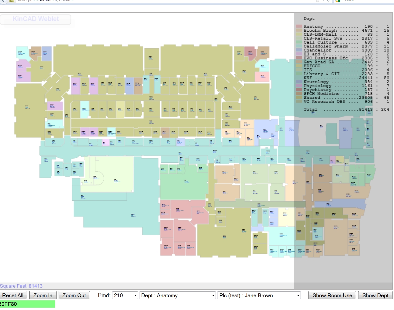
UCSF maintains up-to-date building and floor plans for all University owned buildings.
These plans are linked to an Access database which is used to populate the location field in various existing UCSF institutional databases. HR, EHS, EDS, etc.....
UCSF staff have geo-referenced the floor plans.
This tool would allow staff to view institutional databases on individual floor plans mapped on a room-by-room basis. It would also allow staff to quickly and accurately enter data spatially - such as IT/ENS jacks.
Initially scope would cover Parnassus.
Roll-out to additional sites tbd.
Mike Kincaid - 80 hours
Rick Fisher - 80 hours
Paul Franke - 80 hours
Commenting is closed.
Comments
This would be very helpful